Numarul contractului: 66/30.04.2013
Codul proiectului: PNII-RU-TE-2012-3-0215
Real time integrated earthquake early warning system for Romania (ResyR)

Fig 1. Location of the earthquakes inserted in the database
P wave travel time to stations for a 5 Km depth earthquake

Fig 2. P wave travel time to stations for a 5 Km depth earthquake at 4 stations.

Fig 3. P wave travel time to stations for a 5 Km depth earthquake at 6 stations.

Fig 4 P wave travel time to stations for a 125 Km depth earthquake at 15 stations.
P wave travel time to stations for a 125 Km depth earthquake

Fig 5. P wave travel time to stations for a 125 Km depth earthquake at 4 stations.

Fig 6. P wave travel time to stations for a 125 Km depth earthquake at 6 stations.

Fig 7 P wave travel time to stations for a 125 Km depth earthquake at 15 stations.


Fig 8. Timeline and screenshot for the 2014-11-24, Ml 5.7, H=39 Km Vrancea event together with the errors associated to magnitude and location estimation (in real time)


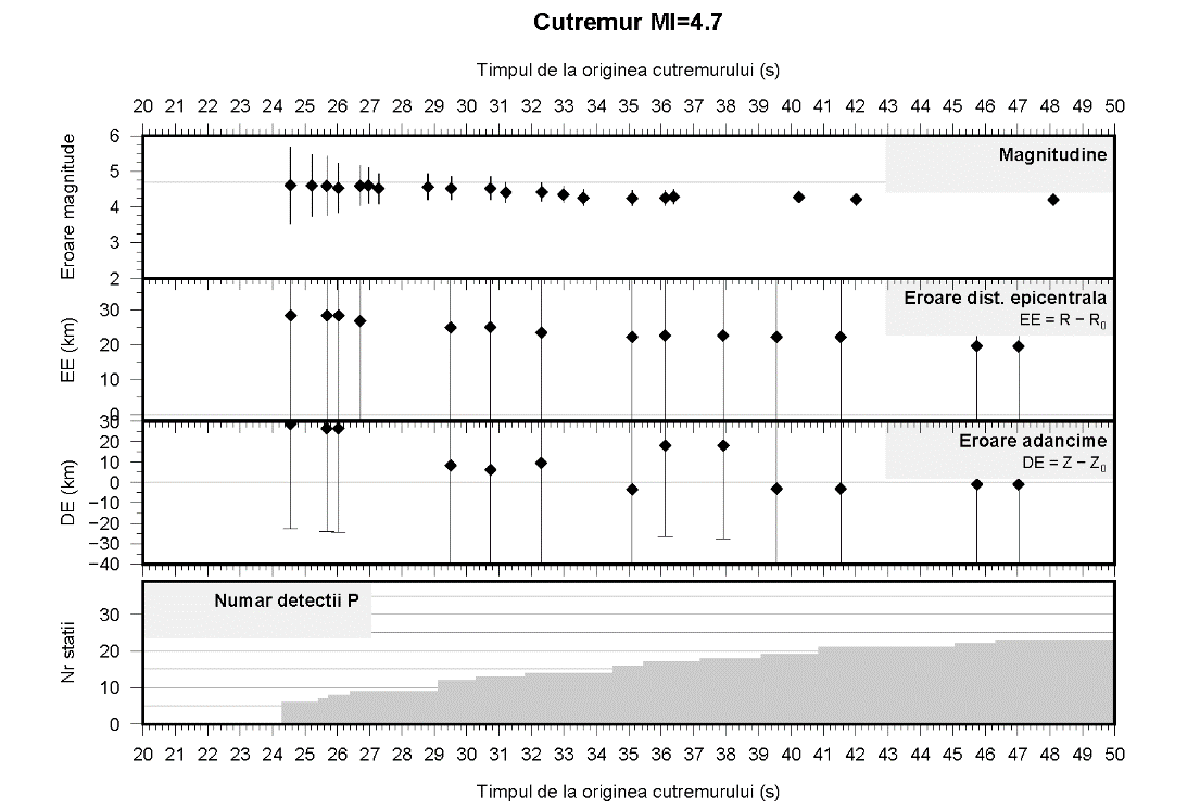
Fig 9. Timeline and screenshot for the 2013-09-9, Ml 4.7, H=5 Km event together with the errors associated to magnitude and location estimation (in real time)

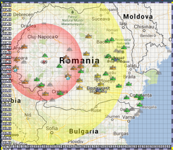
Figura 10. Site-ul alerta.infp.ro


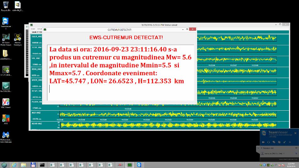
Figura 11. Suita de mesaje de alarmare transmise în urma cutremurului din data de 24.09.2016, ora 02:11:20 produs în zona seismică Vrancea. Pe măsură ce se achiziționează date noi, magnitudinea și localizare cutremurului se îmbunătățesc într-un interval de ordinul secundelor (magnitudine inițială 6 –> magnitudine finală 5,6).

Figura 12. Fereastra aplicației de alarmare afișata in cadrul comandamentului seismic din cadrul INCDFP.(Exemplu: cutremurul din data de 24.09.2016, ora 02:11:20 produs în zona seismică Vrancea)

